| About MMOP |
 |
Programmes > AMP > MMOP > About MMOP
About the Marine Meteorology and Oceanography Programme (MMOP)
|
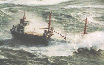
The dangers arising from adverse maritime weather and ocean conditions have been realized since man first went to sea by boat. Coastal areas of the world abound in histories of local fishing fleets tragically lost in heavy seas within a few hours’ sailing time of the safety of a harbour and of sailors drowned in some distant ocean. It is almost not surprising therefore that in many sea-faring countries National Meteorological Services were originally established (from the middle of the 19th century) to issue storm warnings for coastal waters. It was the enterprise of a naval officer, Matthew Fontaine Maury, which led to the convening of the first international meteorological conference at Brussels in 1853. |
| This was the beginning of an international cooperation and a uniform system for collecting weather observations at sea, and for using and exchanging of these data for the benefit of shipping in return. This also aim was to gain knowledge of the climatology of the oceans, and to better define trade shipping routes, to minimize hazards and costs, therefore increase the efficiency of maritime navigation. |
With the development of scientifically based maritime weather forecasting, the tentative efforts of the small group of pioneers at Brussels ultimately led to the establishment of the present Marine Meteorology and Oceanography Programme (MMOP), under the auspicious of the World Meteorological Organization (WMO). One of the main features of the MMOP is the scheme whereby each national Meteorological Service involved assumes responsibility for an agreed area of the high seas and coastal waters. The weather and sea bulletins, which they broadcast by the Global maritime Distress and Safety System (GMDSS) at regular intervals, provide information for the mariners on the location, movement and probably development of weather systems and on the associated weather and ocean conditions; special warnings are given of hazardous situations. Seafarers themselves contribute to the success of the Programme by providing weather observations under WMO Voluntary Observing Ships’ Scheme, in response to the International Convention for the safety of Life at Sea (SOLAS) which specified that “the Contracting Governments undertake the encourage the collection of meteorological data by the ships at sea, and to arrange for their examination, dissemination and exchange in the manner most suitable for the purpose of aiding navigation”.
 |
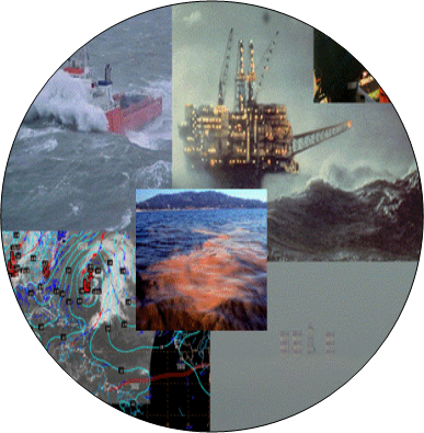
Thanks to above national and international services, countless lives have been saved, but there are still a regrettably high number of shipping and other infrastructure disasters each year in which adverse weather and sea played a role. Every effort must therefore continue to be made to improve the work of the marine meteorological services. Their tasks must in any case be adapted to meet the challenging met-ocean products and services support requirements of the end-users and new application areas that are now becoming increasingly important, such as |
- Offshore resource exploration,
- Military and defense operations,
- Marine engineering,
- Sub-surface communications,
- Tsunami prediction and warning systems,
- Storm surges and coastal defense communities,
- Ship routing and navigation,
- Operations in the marginal ice zone,
- Pollution monitoring prevention and clean-up,
- Sustainable management of commercial fishing,
- Marine and coastal environmental management,
- Synoptic, seasonal and other long-term forecasting,
- Climate predication at different time scales.
|
|
In addition, the recent rapid growth of recreational boating (non-SOLAS vessels) has led to demands for better information about sudden winds associated with thunderstorms and squalls; the small sailing boats so widely used for recreation can easily be capsized, especially in the hands of a relatively inexperienced sailor, by a gust of wind, which would hardly be noticed by a large ship. Those engaged in offshore oil and gas drilling and mining operations need highly specialized weather and sea forecasts. The requirements of hovercraft operators differ from those of conventional shipping.
See also background information and history of the Marine Meteorology and Oceanography Programme here.