|
|||
|
|
|||
|
|
|
WMO Global Hydrological Status and Outlook System (HydroSOS)The challenge
Globally hydrological variability poses one of the greatest threats to the world's population. There are an increasing number of people at risk from water-related hazards and rapidly growing demands on water resources. However, there is currently no global system which is capable of assessing the current status of surface and groundwater systems or predicting how they will change in the immediate future. HydroSOS plans to provide the crucial global scale information needed to help citizens understand the current status of the world's freshwater systems and adapt in light of the near-future outlook by harnessing new technologies and link up other initiatives to enable us to better answer questions like: "How much water is there in rivers around the world at the moment?", "Is the current situation normal?", and "How might the global flood/drought situation change in the coming few months?". The ambitionThe long-term aim of this initiative would be to develop a worldwide operational system at monthly timescales capable of providing:
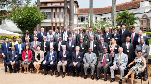
HydroSOS will bring together existing tools and approaches to develop composite products of hydrological status and outlook. The SystemThis important initiative is being led by the Commission for Hydrology and is intending to provide an operational WMO system capable of assessing the current hydrological status and its likely near-future outlook (sub-seasonal to seasonal time frames) for all areas of the globe. The System will be delivered by National Meteorological and Hydrological Services (NMHSs), offering simple, accessible hydrological information to users such as government bodies, basin managers, funding institutions, aid agencies, UN bodies, and the general public. HydroSOS will be developed in phases, with the first one being a pilot phase (2017-2020). Under this phase, several possibilities for basin pilots are being considered with an initial main focus in Africa and South Asia. This initiative is aligned with WMO priorities regarding Disaster Risk Reduction, the Global Framework for Climate Services (GFCS), the WMO Integrated Global Observing System (WIGOS), and Capacity Development. HydroSOS is seen as an important tool to help NMHSs deliver their services. In addition, the system, underpinned by hydrological data sharing, meteorological forecasts and climate prediction information with advances from the global research community, will support the 2030 Agenda for Sustainable Development and, in particular, the broader global community in the area of water management. Initial Planning Meeting of the HydroSOSThe Initial Planning Meeting of the HydroSOS was held in Entebbe, Republic of Uganda from 26 to 28 September 2017, bringing together approximately 50 participants, including some regional and national Hydrological Advisers, international experts, stakeholders from the pilot river basins, and members of the Commission for Hydrology’s Advisory Working Group.
The purpose of the meeting was to establish a dialog in the community to help consolidate the planning of the System by addressing the needs of the various stakeholders and by directly building on recent advances by the global environmental science community, along with other current WMO initiatives and existing capabilities to deliver a unique operational system providing up-to-date hydrological information from NMHSs to a range of end-users.
PresentationsDay 1
Day 2
Day 3
Notes from Rapporteurs
|
|
|||||||||
 ©2017 World Meteorological Organization, 7bis, avenue de la Paix, CP No. 2300, CH-1211 Geneva 2, Switzerland - Tel.: +41(0)22 730 81 11 - Fax: +41(0)22 730 81 81 |
|||||||||||