|
TECHNICAL PROGRESS REPORT ON THE GLOBAL DATA-PROCESSING SYSTEM FOR 1999
MOROCCO
Direction de la Météorologie Nationale (DMN)
1. SUMMRY OF HIGHLIGHTS
Increase of the resolution to 16.7km for ALADIN-Maroc.
Quarterly control of Aladin-Maroc.
Installation of Meteorological Data Base (BDM)
Execution of ARPEGE-CLIMAT in Morocco to produce seasonal forecasts.
Installation of SADIS.
Y2K transition.
2. HARDWARE USED (see figure 1 : Important components of
the data processing)
Information commutators on GTS are the TRANSMET computers (two
Motorola, operating with OS Unix and Oracle).
NWP operational models are running on a CRAY J916 (6 processors and 2
Gbytes memory).
The management of the forecasting system (control of the data in
input of NWP model, preprocessing) is made on CRAY SUPER SERVER 6400 used as file server
and running Oracle, the production of charts with the ALADIN-Maroc output is made on a
CRAY J916 with Magics and NCAR software. The whole system (human facilities, calculation
machine, file sever, workstation for development and ALADIN-Maroc model) is called
ALBACHIR.
Dissemination of forecast and observation products (from GTS
included), in particular to the moroccan weather stations, is made through the fac-simile.
Facilities network assuring the interconnection of the different
networks of the DMN is the FDDI ring.
For getting coupling files from Toulouse and data from GTS a 64
kbytes data link is used to link Casablanca to Toulouse.
3. USE OF DATA PRODUCTS FROM GTS
The following types of observation, extracted from GTS are presently
used at the DMN :
SYNOP, SHIP, BUOY, BATHY,
METAR
TEMP, TEMPSHIP, PILOT,
AIREP, AMDAR, ACARS,
SATOB, SATEM
GRID and GRIB products received from Toulouse.
Fac-simile products:
4. DATA INPUT SYSTEM
Automated.
5. QUALITY CONTROL SYSTEM
The format of all coded reports are checked and if necessary
corrected if possible.
All received messages are checked for internal consistency before
storing and exchange.
Space consistency check.
Time series consistency check.

Fig 1 :Important components of the data processing
6. FORECAST SYSTEM
The operational forecast system at DMN is based on ALADIN library
developed jointly by Météo-France and the national meteorological or hydrometeorological
services of the following countries :
Austria, Belgium, Bulgaria, Croatia, Czech, Republic, Hungary, Moldova,
Morocco, Poland, Portugal, Romania, Slovakia, Slovenia.
ALADIN (0-48hours)
ALADIN is a limited area version of ARPEGE-IFS. This implies that :
ALADIN is spectral (like ARPEGE-IFS)
As spectral-LAM it works on a biperiodic domain and uses bi-Fourier
horizontal transforms
Its physics and ARPEGE one are identical
It gets initial and boundary conditions from ARPEGE
Up to now ALADIN-Maroc is run in mode with data assimilation.
The ALADIN-Maroc is using a two time level semi lagrangien scheme with
a time step value to 675 s and an horizontal resolution about 16 km. The integration is
done over the domain centred on Morroco and limited by (18.4 to 43) on latitude and (
-19.8 to 9.8) on longitude.
The vertical resolution is 31 levels, with an increased density in the
low atmosphere, the first level is at 5 hPa. The digital filter initialization uses a
Dolph-Chebishev filter with a stop-band edge period of three hours and a backward-forward
scheme.
This version of ALADIN-Maroc is running twice a day up to 48 hours
range, with initial and lateral boundary conditions given by the corresponding ARPEGE run.
It is based on hydrostatic assumption.
The post-processing is performed every three hours then grib files and
graphical charts are produced and sanded to forecaster workstation Synergie.
6.1 . Schedule of the Forecast System
The operational forecast system at DMN is based on ALADIN-Maroc runs
using the observed data at 00 UTC and at 12 UTC :
00 UTC data : ALADIN-Maroc analysis and forecast up to 48h
12 UTC data : ALADIN-Maroc analysis and forecast up to 48h
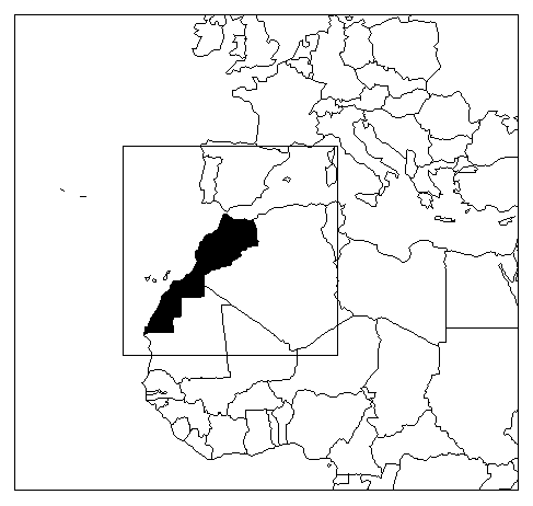
Domain of the ALADIN-Maroc model
Mesh size ~ 16.7 km, 180x180 gridpoints
6.2. Assimilation, objective analysis and initialization
The Aladin-Maroc is running operationally with data assimilation cycle
and Canari analysis. Now, the Meteorological Data Base (BDM) is installed and the
assimilation is using local observations file merged to the observation file received from
Toulouse (like the coupling files), at the end of this project the observation files will
be performed in Casablanca (only ARPEGE analysis departures are needed from Toulouse).
The assimilation runs with a 6 hour cycle, the analysis works in
vorticity, unbalanced divergence/ temperature/surface pressure and specific humidity on
model levels.
Assimilation data : |
TEMP and TEMPSHIP (part A, B, C and D),
PILOT (part A, B, c and D), AIREP, AMDAR, ACARS, SATOB, SATEM with observation time in
[H-3h, H+3h] for the analysis at H, SYNOP, SHIP, BUOY BATHY with observation time in
[H-30', H+30']. |
Assimilation cycle : |
6 hour cycle. |
Analysed method : |
Optimal Interpolation. |
Analysed variables |
Wind, temperature, surface pressure and
specific humidity on model levels. |
First guess : |
A 6-hour forecast of ALADIN-Maroc. By
default a 12, 18 or 24-hour forecast. |
Horizontal resolution : |
Linear grid (180 x 180 points) equivalent
to (2800x2800 km). |
Vertical resolution |
The analysis is done on the model levels:
31 levels (hybrid vertical co-ordinate) from screen up to 5 hPa. |
Initialization : |
Incremental digital filter initialization
(ie filtering analysis increments fields) using a Dolph-Chebishev filter with a stop-band
edge period of 5h and a backward-forward scheme. |
Surface : |
analysis of superficial and mean soil temperature from forecast
errors on 2m temperature
analysis of superficial and mean soil moisture from forecast errors
on 2m temperature and 2m relative humidity
small relaxation towards climatology for snow and mean soil
temperature and moisture
|
6.2 Model
Basis equations : |
Primitive equation system |
Independent variables : |
Both components of the horizontal wind,
temperature, specific humidity and surface pressure. |
Dependant variables : |
Vertical velocity and density. |
Numerical technique : |
Spectral and semi-lagrangian model, the
temporal discretization used is
leap-frog semi-implicit scheme. |
Integration domain : |
the limited area domain centered on
Morocco. |
Orography, gravity wave drag : |
The orography of this model on grid
(180x180 points) is obtained from GTOP030 US Geological Survey's EROS data and US NAVY 10'
data, that strongly reduces the noise associated to Gibbs waves. |
Horizontal diffusion : |
Implicit in spectral space and
incorporating an orography dependent correction for temperature. |
Vertical diffusion : |
Scheme linked to PBL. |
Planetary boundary layer : |
ECMWF method (Louis et al. 1981). |
Resolution, time step : |
It has 16.7km mesh and 31 vertical levels
from screen up to 5hPa, using the hybrid (s,p) co-ordinate from Simmons and Burridge
(1981). The time step is 675 seconds. |
Earth surface : |
Fixed analyzed sea surface temperature and
amount of sea-ice. An improved version of the ISBA (Interaction Soil Biosphere Atmosphere)
schema is used, including an explicit parameterization of soil freezing. Six prognostic
variables are handled by ISBA : surface temperature, mean soil temperature, interception
water content (first centimeter), total liquid soil water content, total frozen soil water
content and snow cover. |
Radiation : |
Hypersimplifed scheme at every time step
(Ritter and Geleyn 1992). |
Convection : |
Mass flux scheme (Bougeault 1985) modified
by Geleyn and. lvanovici |
Humidity : |
Specific humidity is the variable: no
storage of condensate; evaporation of falling rain; treatment of the ice-phase. |
Limits : |
(18.4 to 43) on latitude, ( -19.8 to 9.8)
on longitude. |
6.3 NWP Products
The above described numerical model feed a archive robotic with
analysis and forecast files, having following characteristics :
horizontal domains and horizontal resolution (18.4N to 43N, -19.8W to
9.8E with a 0.15° mesh)
Vertical levels are the standard pressure levels.
The meteorological fields stored are :
at all levels : geopotential, temperature, humidity, wind (including
vertical velocity)
at screen level : pressure, temperature, humidity, heat and radiation
fluxes, snow and water content
at sea surface level : reduced pressure
some data at particular levels : 500hPa absolute voracity, high
medium and low cloudness, iso 0° and iso –10°, tropopause etc …
6.4 Operational use of NWP products
On screen (especially SYNERGIE workstation) or on paper …
7.SPECIALIZED FORECASTS
7.1. Local weather elements
We plan to make several kinds of forecasts by statistical adaptation of
the NWP products from the above described model, we started with Min-max daily temperature
over 40 station in Morocco.
7.2. Marine forecasts
The model run operationally in Morocco determining the sea conditions :
DSA5, computing the waves over the northern hemisphere part of the
Atlantic ocean, from the wind outputs of large scale fields derived from ARPEGE.
This model is available between 0430UTC and 0500UTC, on 00UTC run.
The model is running once a day based on 00 UTC, up to 48h.
8. CONTROL OF THE MODEL ALADIN-Maroc
Only the values given by ALADIN-Maroc at moroccan station are
controlled by comparison to the observations at this station, statistics are produced
every three months and summarised in a quarterly bulletin.
Quarterly scores (October – November – December 1999 )of the
operational ALADIN-Maroc model :
2m TEMPERATURE (degres celsius )
| |
Forecast range |
| |
06H |
12H |
24H |
36H |
48H |
Bias |
-1,42 |
-0,52 |
-2,38 |
-0,59 |
-2,66 |
RMS |
3,40 |
2,35 |
3,73 |
2,49 |
4,04 |
SD |
2,07 |
1,98 |
2,03 |
2,09 |
2,17 |
MLS PRESSURE (Pascal)
| |
Forecast range |
| |
06H |
12H |
24H |
36H |
48H |
Bias |
46,02 |
-25,88 |
-55,73 |
-64,59 |
-76,14 |
RMS |
167,29 |
136,88 |
151,89 |
169,02 |
174,16 |
SD |
133,60 |
111,15 |
118,99 |
130,07 |
136,86 |
10m WIND (m / s)
| |
Forecast range |
| |
06H |
12H |
24H |
36H |
48H |
Bias |
0,05 |
-0,62 |
0,07 |
-0,70 |
0,01 |
RMS |
1,97 |
2,31 |
2,00 |
2,35 |
2,04 |
SD |
1,69 |
1,94 |
1,73 |
2,00 |
1,80 |
COULD COVER ( % )
| |
Forecast range |
| |
06H |
12H |
24H |
36H |
48H |
Bias |
-1,17 |
-5,98 |
4,40 |
-5,91 |
4,65 |
RMS |
33,34 |
29,46 |
33,23 |
30,34 |
32,97 |
SD |
32,46 |
28,01 |
31,87 |
28,96 |
31,75 |
SOIL HUMIDITY ( % )
| |
Forecast range |
| |
06H |
12H |
24H |
36H |
48H |
Bias |
-4,29 |
1,03 |
-0,53 |
1,11 |
0,30 |
RMS |
17,64 |
17,57 |
16,79 |
17,92 |
16,58 |
SD |
15,03 |
16,36 |
14,91 |
16,56 |
14,48 |
Bia |
: |
Mean error |
RMS |
: |
Root Mean Square erreur |
SD |
: |
Standard Déviation |
CONTINGENCY TABLE FOR PRECIPITATION ECHE_12
| |
P<0,1 |
0,1<P<2 |
2<P<10 |
P>=10 |
Total |
P<0,1 |
76,55% |
6,25% |
3,77% |
1,67% |
88,24% |
0,1<P<2 |
2,66% |
1,43% |
1,33% |
0,60% |
6,01% |
2<P<10 |
0,55% |
0,58% |
0,98% |
0,33% |
2,43% |
P>=10 |
0,00% |
0,03% |
0,14% |
0,35% |
0,53% |
Total |
79,75% |
8,29% |
6,22% |
2,96% |
97,22% |
| Best forecast : 79,31% |
Skill score : 0,258
|
Recall :
DMN draws up a "quarterly bulletin of control" (in french).
These bulletins can be obtained by writing to :
Direction de la Météorologie Nationale
Centre National de Recherches Météorologiques
BP : 8106 Casablanca-Oasis
CASABLANCA
MOROCCO
Email : dmn@mtpnet.gov.ma
9. Y2K TRANSITION
All the operational services related to the three functions :
Observation, Reception/Transmission and production passed successfully the Y2K.
No problem had been noticed for these functions which were the strict
necessary tasks that must be safe ensured.
The regular users of DMN product received normally all the requested
meteorological information during the critical period.
10. FUTUR PLANS
Acquisition of a preferment computer.
Use of multivariate three dimensional variational analysis.
Running a non-hydrostatic version of ALADIN-Maroc.
Operational seasonal forecast using ARPEGE-Climat.
Running the regional ALADIN model in the regions on workstation.
|