|
|||
|
|
|||
|
|
|
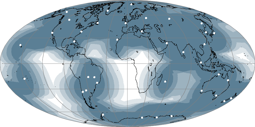
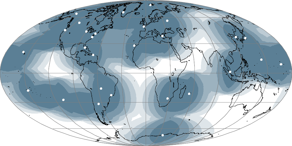
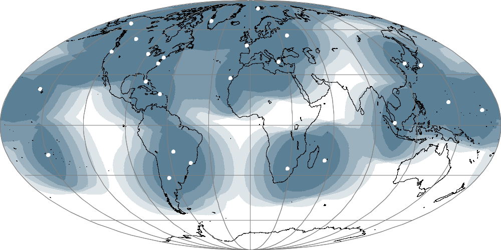
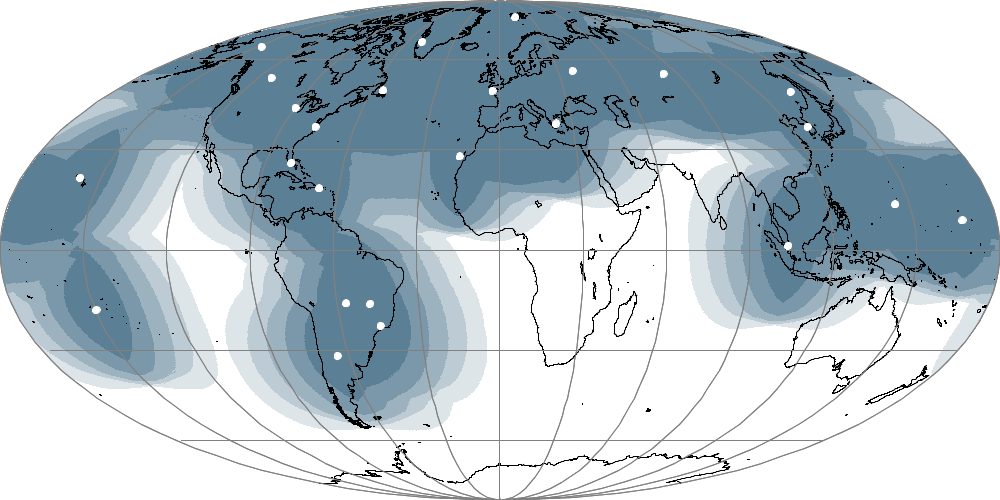
DBNet Implementation StatusThe status of implementation of the main DBNet services is shown in the following diagrams:
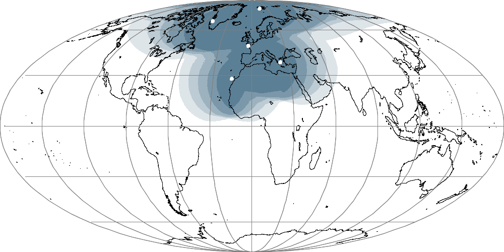
Maps by Anders Soerensen, EUMETSAT A list of the current and planned participating HRPT stations is available (See the DBNet Network Status and Plans below), with their geographical coordinates and BUFR identifiers. The planned expansions will contribute to filling the geographic gaps visible on the graphics. DBNet Product MonitoringData quality flags and other indicators are generated when the data are processed by the AAPP software. Embedded in the format of the retransmitted data, they alert to any inherent quality problems that might be present in the data themselves. Routine DBNet data monitoring takes place at two levels:
Monitoring by Regional Processing Centres Service-related information is also gathered and published by the respective DBNet Regional Processing Centres. They monitor the completeness of the data that they receive from direct readout stations by comparison with the data expected from the nominal regional configuration. Additional factors are monitored by regional centres such as end-to-end timeliness indicators, or consistency of the navigation. Monitoring by the NWP SAF The NWP SAF lead institute, the UK Met Office, is responsible for routinely and automatically performing comparisons of DBnet data sets and the equivalent data in the global data sets received via another means. In this way the DBNet data sets are examined for consistency with equivalent data that has not passed through the DBNet processing chain. Such consistency is vital to enable the DBNet data to be used alongside global data, for example, in NWP applications. The NWP SAF publishes the results of the consistency checks on the NWP SAF web site and has the capability to generate alerts and send them via email to the appropriate centre. Data locally received in Exeter, UK are also compared with corresponding DBNet data.
DBNet Data Access
|
|||||||||||||||||||||||||||||||||||||||||||||||||||
Role |
Name |
Email address |
|---|---|---|
DBNet Asia-Pacific |
Ms Kelly Desker Mr Tasuku Tabata |
kelly.desker@bom.gov.au t_tabata@met.kishou.go.jp |
DBNet South America |
Mr Sergio Pereira Ms Gloria Pujol |
sergio.pereira@inpe.br gpujol@smn.gov.ar |
DBNet EUMETSAT (EARS) |
Mr Nicholas Coyne |
nicholas.coyne@eumetsat.int |
DBNet NOAA coordinator
|
Dr Mitch Goldberg Mr Liam Gumley |
mitch.goldberg@noaa.gov liam.gumley@ssec.wisc.edu |
WMO Space Programme |
Werner Balogh |
wbalogh@wmo.int |
Links to Websites of DBNet Operators
(for operational information concerning the provision of the DBNet services)
DBNet |
Web site |
|---|---|
EUMETSAT (EARS) |
http://www.eumetsat.int/website/home/Data/RegionalDataServiceEARS/index.html?lang=EN |
Asia-Pacific |
|
South America |
Not available yet |
| NOAA | Not available yet |
Other Links
NWP SAF: http://nwpsaf.eu (Providing AAPP Software and global monitoring)
NWO SAF global monitoring: http://nwpsaf.eu/site/monitoring/dbnet
Meeting Reports
Reports from DBNet Coordination Group meetings and other relevant meetings may be viewed on the Meeting Reports page (Type DBNet or RARS as search keyword)
A global network of Regional ATOVS Retransmission Services (RARS), by M.Dumont, J. Lafeuille, A.Soerensen. Paper presented at the 15th International TOVS Study Conference (ITSC XV, Maratea, October 2006).
Update on the RARS project, by D. Griersmith, paper presented at the 16th International TOVS Study Conference (ITSC XVI, Angra dos Reis, Brazil, May 2008)
"Evolution of the EUMETSAT ADvanced Retransmission Service (EARS)", by C. Ponsard, A. Soerensen, D. Lee, at NOAA's 2008 Satellite Direct Readout Conference (Miami, Florida, USA, 8-12 December 2008).
"RARS Global Network Status and Plans", by J. Lafeuille, poster presented at the 17th International TOVS Study Conference (ITSC XVII, Monterey, Ca, USA, 14-20 April 2010)
WMO Space Programme data access challenges: update on the RARS initiative, by J.Lafeuille, Netspace Workshop, Athens, February 2014.